2025年5月4日に行われるスカイランナーワールドシリーズの上田スカイレース。私はランナーではないので上田スカイレースに出ないが、世界レベルの大会を体感しようと思い、コースを試走してみた。
体力不足により残念ながら秋和でDNFとなったがそれでも一部コースを紹介する。
The Ueda Skyrace (Skyrunner World Series) will be held on May 4th in Ueda, Japan. I will introduce the course from the beginning to the latter half.
- 大星神社〜太郎山山頂 Oboshi shrine 〜 summit of Mt.Taro
- 太郎山〜虚空蔵山 Mt. Taro〜Mt. Kokuzo
- 虚空蔵山〜下塩尻 Mt. Kokuzo 〜 Shimo-Shiojiri
- 下塩尻〜上塩尻 Shimo-Shiojiri ~ Kami-Shiojiri
- 上塩尻〜秋和 Kami-Shiojiri ~ Akiwa
- コース全体として Welcome to Mt. TARO & Ueda-City!
大星神社〜太郎山山頂 Oboshi shrine 〜 summit of Mt.Taro

大星神社からバイパスを渡りここから入山。四十八曲がりコース。バーティカルも同じ入山口。
Starting from Oohoshi Shrine, this is the entrance to the mountain.

イノシシが登山道を通った痕跡。
Traces of a wild boar passing through the hiking trail.

四十八曲がりは葛折の急坂が続く。
The steep, winding climb continues.
古井戸の分岐で左の白蛇コースの下りに入る。
At the fork in the road to Furuido, take the descent down the Shirahebi course on the left.
試走ランナーにサクッと抜かれる。ジグザグの道は狭いが明瞭。
ここが少しテクニカル。落ち葉と石のミックス。
The trail is difficult to walk on as the surface is a mixture of fallen leaves and stones.
落ち葉の中にゴロゴロとした石が混じっている。
分岐を右に行く。
Go right at the fork.
少し登ってまた下る。
Climb a little and then go down again.
下る。

牛伏コースと白蛇コース分岐。
The fork in the road between the Ushibuse Course and the Hakujya Course.
神社で折り返し。
牛伏コースを登り返す。
Climb back up the Ushibuse course.
城の跡。
Remains of a medieval castle.

しばらくは快適な道だったがだんだんと急になる。
The trail was comfortable for a while but then it got steeper.
かなり斜度がきつく足が滑る。四つん這いじゃないと登れない。最後にここを下りで使うが選手がスライディングで降りるところだ。
The slope is quite steep and your feet will slip. You can only climb on all fours. This is the last place we use for the descent, and the athletes slide down.
牛伏コースと表参道コースとの出合い。
The meeting point between the Ushibuse Course and the Omotesando Course.
赤鳥居。AKADORII
桜が綺麗。
太郎山神社。TARO-SHURINE
本日の装備。Today's equipment.
太郎山山頂。北アルプスの山並みと桜が綺麗。
The summit of Mt. Taro. The Northern Alps and cherry blossoms are beautiful.
太郎山山頂。The summit of Mt. Taro. Overlooking Ueda city.
太郎山〜虚空蔵山 Mt. Taro〜Mt. Kokuzo

ここから虚空蔵山方面へ。From here, head towards Mount Kokuzo.
西峠は広々している。虚空蔵山方面へ。From here, head towards Mount Kokuzo.
快適な縦走路。A comfortable trail continues.
弥五郎峰。北アルプスの眺めが良い。Yagoro Peak. Great view of the Northern Alps.

坂城方面と北アルプス。
ロープが設置されている狭いトラバース。A narrow traverse with ropes installed.
亀井城跡。Remains of a medieval castle.
積城跡。Remains of a medieval castle.
分岐はまっすぐ進む。The fork goes straight ahead.
虚空蔵山直下の岩場。まるで修験の山。A rocky area directly below Mount Kokuzo.
虚空蔵山山頂。The summit of Mt. Kokuzo.
虚空蔵山〜下塩尻 Mt. Kokuzo 〜 Shimo-Shiojiri
 虚空蔵山を過ぎると急な下りが続く。ロープが設置されている。
After passing Mount Kokuzo, there is a steep descent. There are ropes set up.
分岐はまっすぐ進む。The fork goes straight ahead.
高津屋城跡。小ピークを越えつつ下り基調で進む。Remains of a medieval castle.
The climb continues downwards, crossing small peaks.
急な下り。危険マークあり。Steep descent. Danger signs.
階段あり。There are stairs.
林道とコースが交差する。The trail intersects with the forest road.
さらに下る。A slippery descent.
ここの分岐を左に下りる。下塩尻方面へ。
Take a left at the fork here and head down towards Shimo Shiojiri.
下塩尻。石堤は越えないで手前を左に曲がり沢に入り折り返す。
Shimo Shiojiri. Don't cross the stone embankment, but turn left just before it, enter the stream and turn back.
下塩尻〜上塩尻 Shimo-Shiojiri ~ Kami-Shiojiri
 枯れた沢の内部を登る。羽虫が多い。
Climbing inside the dried up stream. There are a lot of flying insects.
やがて沢を抜ける。Eventually we come out of the stream.
急な斜面を登る。路面が悪い。We had to climb a steep slope. The road surface was bad.

ここまでで一番路面が悪い。滑落注意。
The road surface is the worst so far. Be careful of slipping.
物見城跡。Remains of a medieval castle.
分岐を稜線方向ではなく下り方向へ。
At the fork, head downhill instead of along the ridge.
道がバンクしている。
The road is banked. Be careful not to slip.
ケムリの城跡。Remains of a medieval castle.
危険な下り。A dangerous descent.
ゴーロの下り。浮石だらけ。Going down a goro slope. Lots of loose rocks.
まもなく上塩尻エイド。
We will soon reach Kami Shiojiri aid station.
上塩尻エイド。神社がある。
Kami-Shiojiri Aid Station. There is a shrine there.
上塩尻〜秋和 Kami-Shiojiri ~ Akiwa

持越城跡。Remains of a medieval castle.

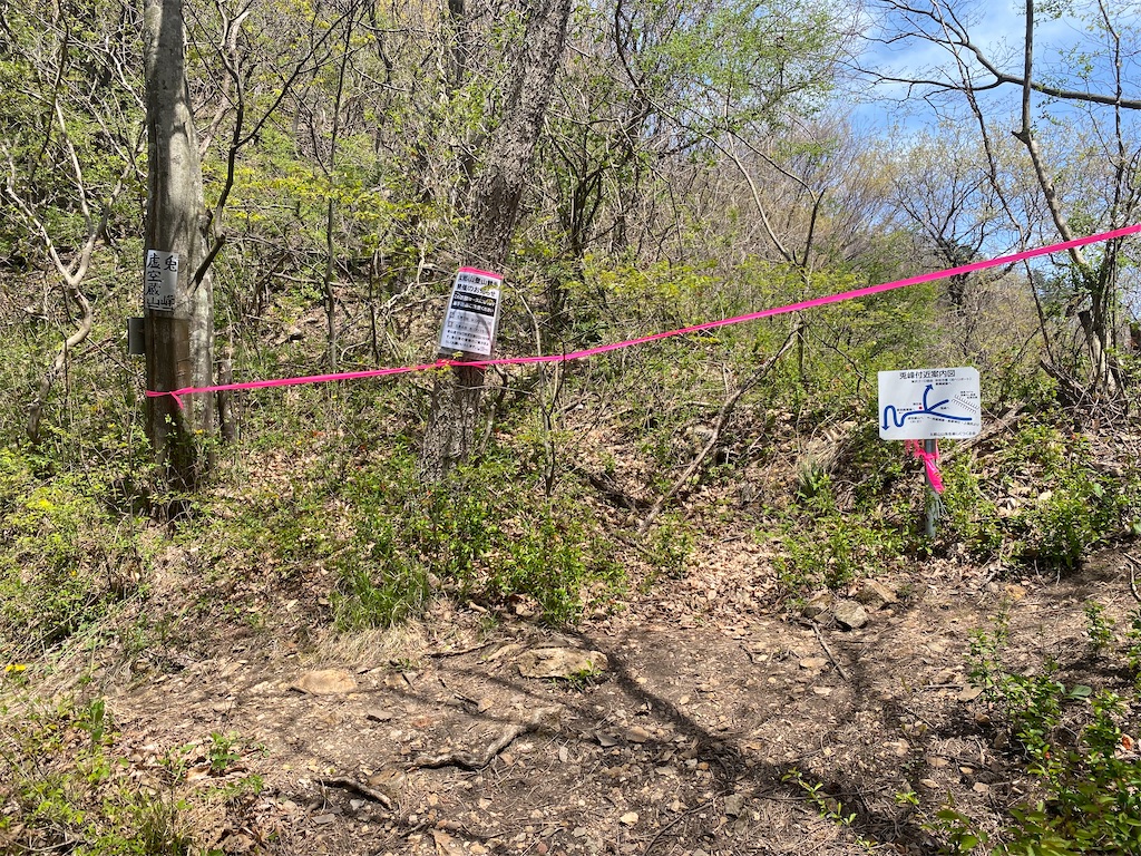
兎峰までの登りは道は比較的整備されている。
The path up to Usagi Mine(RABBIT PEAK) is relatively well maintained.
虚空蔵山方面の岩峰が見事。
The rocky peaks in the direction of Mount Kokuzo are magnificent.
この先、兎峰の直登がコースだがかなりわかりにくく、一度見逃してしまった。
From here onwards, the course is a direct climb up Usagi Mine, but it is quite difficult to see and I missed it once.
ピンクの印を頼りに兎峰を登る。
Climb Usagi Mine following the pink marks.
かなり道が悪い。落石注意。
The road is in pretty bad condition. Be careful of falling rocks.
兎峰への最後の登り。
The final climb to Usagimine.
兎峰の上はナイフリッジ。左右が切り立っていて最も注意が必要。
The knife-edge ridge of Usagimine. Both sides are steep so you need to be extremely careful.

兎峰。RABBIT PEAK
兎峰から上田市街を望む。Ueda City
兎峰から弥陀平エイド方面に下る。
From Usagimine, descend towards Midadaira aid station.

兎峰からの下りはかなり急で滑る。ロープを掴んだ方が安全。
The descent from Usagimine is quite steep and slippery. It is safer to hold on to the rope.
名物ともいえるゴーロ地帯。北アルプスの岩稜を彷彿とさせるが、浮石が多く危険。
The famous Goro area is reminiscent of the rocky ridges of the Northern Alps, but it is dangerous due to the many loose rocks.
ジグザグに下っていく。
弥陀平エイド。Midadaira aid station.
ここからまた少し登り返し。From here it's a bit of a climb back up.
分岐を飯縄城跡方面へ下る。
Take the fork down towards the Iizuna Castle ruins.
快適な尾根道。
飯縄城跡は広い。Remains of a medieval castle.
梯子あり。Climb the ladder.
城跡を越えると道が急に悪くなる。急斜面。
Once you pass the castle ruins, the road suddenly becomes rough and steep.
滑りやすい土と岩の組み合わせの急斜面。
A steep slope with a combination of slippery soil and rocks.
滑りやすい土と岩の組み合わせの急斜面。
A steep slope with a combination of slippery soil and rocks.
獣侵入防止ゲートをくぐって墓地へ。
Go through the animal-proof gate to the cemetery.
墓地を抜ける。
Go through the animal-proof gate to the cemetery.
墓地を抜けて集落へ。
Pass through the cemetery and head into the village.
国道18号バイパスに沿って少し進むと秋和エイド。私は残念ながらここで体力が尽きてリタイヤした。本当ならここから奥の神社から山に入りトラバース気味に東へ進み、生塚神社から尾根を直登し西峠へ出て、太郎山に登るコースとなっている。
A little further along National Route 18 Bypass is the Akiwa Aid Station. Unfortunately, I ran out of energy here and had to retire. The correct course is to enter the mountain from the shrine in the back, head east in a sort of traverse, go straight up the ridge from UBUZUKA Shrine, exit at Nishitoge Pass, and climb Mt. Taro.
コース全体として Welcome to Mt. TARO & Ueda-City!
市街地の近さとは裏腹に非常にタフな山である。アップダウンのほとんどは危険な急斜面でありテクニカル。ナイフリッジや岩場もあり、スピードを出して走るのは難しい箇所が多い。しかし日本らしい緑の濃い森林や多様な草花、富士山や北アルプスの景観など見どころも多い。日本の中でこんなに市街地に近く景色も良くテクニカルなレースができる山は他にないだろう。上田の山をぜひ楽しんでほしい。
Despite its proximity to the city, this is an extremely tough mountain. Most of the ups and downs are dangerously steep and technical. There are also knife-edge ridges and rocky areas, making it difficult to race at high speed in many places. However, there are many attractions, such as the lush green forests typical of Japan, a variety of flowers, and views of Mt. Fuji and the Northern Alps. There is probably no other mountain in Japan that is so close to a city and offers such beautiful scenery and the opportunity for technical racing.I hope you enjoy the mountains of Ueda.
2025年4月29日
おわり